|
PICTURE
OF THE WEEK ARCHIVE
07.08.07

click image to enlarge
On July 8, 2007 the cameras
on the AIM satellite took this exciting picture of noctilucent
clouds over the North Polar region. These data (see scale:
red being bright) reveal for the first time very bright but
spatially small (~20 to 30 km in diameter) polar mesospheric
clouds that rise in brightness significantly above the background
cloud deck (green and blue). These small, bright clouds have
never been observed before and are the result of complicated
dynamics in the 80 km region of the atmosphere.
Credit: Cloud Imaging and Particle Size Experiment
data processing team at the University of Colorado’s
Laboratory for Atmospheric and Space Physics.
06.11.07

Click image to enlarge.
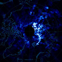
On June 11, 2007 the cameras on the
AIM satellite returned some of the first data documenting
noctilucent clouds over the Arctic regions of Europe and North
America. This new data reveals the global extent and structure
of these mysterious clouds, to a degree that was previously
unattainable. White and light blue represent noctilucent cloud
structures. Black indicates areas where no data is available.
Credit: Cloud Imaging and Particle
Size Experiment data processing team at the University of
Colorado Laboratory for Atmospheric and Space Physics
|
